Goals and Objectives
Project Goal
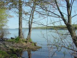
The project goal is to protect ground and surface water quality and conserve viewsheds and agricultural areas through the identification of environmentally sensitive areas. These efforts will be followed by the application of remedial, regulatory and programmatic steps that can be taken to address existing or potential negative impacts, particularly large lot development, on rural-agricultural and shoreline areas in the Finger Lakes. This type of development could result in a loss of large contiguous areas for agricultural use and open land not in production. The viability of the agricultural industry could be impaired through the removal of critical masses of land, through large lot development, that are needed to support growers, farm suppliers, food processors and other businesses that depend on a healthy agricultural industry. Additionally, the existence of broad expanses of open land and viewsheds characteristic of the Finger Lakes area would be lost over time. Further, the quality of ground and surface waters could be jeopardized resulting in a variety of negative outcomes including further impact on the agricultural industry and contamination of drinking water sources.
Project Objectives
During the initial stages of this project, a prototype will test methodologies in the Owasco Lake Watershed. This testing will allow adjustments in the project approach prior to implementation on a larger scale. The following are objectives for the prototype project.
- Establish the project approach. The project will develop, test and refine a data analysis approach, using the prototype area, before proceeding with the entire Finger Lakes Region.
- Identify environmentally sensitive areas. The Institute for the Application of Geospatial Technology (IAGT) will be combining a variety of Geographic Information Technologies (GIT) including satellite imagery, aerial photography, and LIDAR elevation data fused with 3-dimensional interactive visualization to identify environmentally sensitive areas.
- Assess existing municipal land development regulations and identify alternative remedial measures. Using the GIT information, various photographs, and imagery (all provided by the IAGT), the Central New York Regional Planning and Development Board (CNYRPDB) will work with the municipalities to assess the ability of current local development policies and regulations to provide the desired level of environmental protection for maintaining the region's agricultural setting, as well as the high quality of its lakes and other water resources.
- Prepare a build-out scenario. A build-out analysis will be performed by CNYRPDB that demonstrates what the landscape could look like if the current land development patterns continued for another 10-20 years. Thus, years of development activity are projected into a fictional portrayal allowing decision makers a look into the likely future. This analysis helps residents analyze and visualize the possible impact of cumulative growth.
- Provide technical assistance in implementing remedial measures. To protect water quality and maintain open land and a viable agricultural industry, local governments will have the opportunity to receive technical assistance in strengthening policies and regulations in order to achieve locally desired results. The IAGT will make the prototype technology available, improved via feed back from the stakeholder group, throughout the Finger Lakes region, between October 2003 and August 2004. The IAGT will also work to find ways to sustain these technical capacities over time.
Funding Source
Funding for this project was secured by U.S. Congressman James T. Walsh, through grants from the National Aeronautics and Space Administration and the U.S. Department of Housing and Urban Development.
|